
Inset
SCALE — bigger map, less detail; smaller map, more story — pick on purpose.
Listen along — Inset
Loading audio…
Press play to listen along. The line being read lights up as you go.
Show full transcript
Loading transcript…
Chapter 2 — Inset and the Map Within the Map
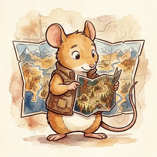
On the widest table in MapForge, a field-mouse-tween named Inset spread out a map of the whole region and frowned at it like it had said something rude.
The map was enormous. It showed everything — the eastern hills, the river that split the plains, three towns, a coastline. And yet, standing over it, Inset looked unhappy. She tapped one tiny dot near the river.
“That dot,” she told the older mouse next to her, “is my whole village. Every garden. Every crooked fence. The pond where I learned to swim.” She squinted. “And on this map, it’s smaller than a crumb.”
“Well, it’s a big map,” the older mouse said. “Can’t fit everything.”
“Exactly.” Inset’s eyes lit up, which was alarming, because she pulled a second map out of her vest — a small folded square — and snapped it open right on top of the first. This one showed only the village: every garden, every crooked fence, the pond. “So I made a smaller one. Same place. But now you can see it.”
She laid the little map inside a neat box drawn on the big one, so the crumb and the close-up sat side by side.
“Bigger map, less detail,” she said, patting the huge one. “Smaller map, more story.” She patted the little one. “Same dirt under both. They just don’t agree about what matters.” She grinned. “Neither one is lying. They’re both choosing.”
Inset had learned about choosing the hard way, back when she was small.
Her family were territory-walkers — field mice who’d spent generations learning the land around the village by walking it. When she was little, she’d tried to draw the entire territory on one page: every root, every anthill, every blade of grass she could remember. She’d worked at it for a whole afternoon, adding and adding, until the page was a black smudge of too many lines. You couldn’t find the pond in it. You couldn’t find anything.
She’d cried, a little. It felt like failing. I remembered all of it, she thought, and it still came out as nothing.
Her grandmother had sat down beside her and looked at the ruined page for a long time. She didn’t say it was messy.
“You tried to keep everything,” she said gently. “That’s not greedy, little one. That’s love. But a map that keeps everything shows nothing.” She smoothed out a fresh page. “The question isn’t how do I fit it all. It’s what is this map for? Answer that, and it tells you what to leave out.” She tapped the blank page. “Leaving things out isn’t losing them. It’s aiming.”
Inset drew the pond that day. Just the pond, and the path to it. And for the first time, someone else could find their way there.
She walked to MapForge at twelve, because a place that studied maps ought to understand the thing nobody talked about: that every map is mostly the stuff it didn’t draw.
Atlas, the old mentor, met her at the gate. He didn’t ask her to prove she was clever. He asked one question. “What is scale?”
Inset didn’t answer with a definition. She unfolded her two maps — the whole region, and the tiny village box tucked inside it — and set them on the gate-stone.
“Bigger map, less detail,” she said, pointing. “Smaller map, more story.” She looked up at him. “It’s a trade. You can cover a lot of ground, or you can show a lot of detail. You can’t do both on one page. So you pick — on purpose — depending on what the map is for.”
Atlas studied the little village box for a long moment. “And who decides what stays in?”
“The mapmaker,” Inset said, quieter. “That’s the part people forget. What you keep is what you thought was worth keeping.”
“You belong here,” Atlas said.
Inset’s workshop was full of the same place drawn a dozen different ways.
A girl came in one afternoon, cross, holding a crumpled map she’d made of her walk to school. “It’s wrong,” she said. “I put in every single thing and it’s a mess. You can’t even tell where the school is.”
Inset knew that mess. She’d made it herself, once, on an afternoon that ended in tears.
“How far is your walk?” she asked.
“Just to the end of the lane.”
Inset pulled down two maps from the wall. “This one’s a world map. See the whole coastline — but not one single street. And this one” — she unrolled a close, detailed sheet — “is four streets. Every doorway. No coastline at all.” She set them beside each other. “Same trade, both times. The world map picked coverage. The street map picked detail. Your walk to school is a street-map question. So draw it like one.”
“But then I have to leave out loads of stuff.”
“Yep.” Inset handed her a fresh page. “Leave out the far hills. Leave out the river. Keep the lane, the corner, the gate, the door.” She pointed to a faint line at the edge of the world map. “And see here — mapmakers simplify on purpose. Fewer roads. Fewer rivers. They call it generalizing. It’s not laziness. It’s aiming.” She tapped the little line on the bottom of the map, the one marked 0 — 10km — 20km. “That bar? That’s how you keep it honest. It says how much real ground each step on the page really is. Never draw a map without one.”
The girl drew her four streets. When she finished, you could find the school in a heartbeat.
“Better?” Inset asked.
“Loads.” The girl paused. “But now the river’s just… gone.”
“It’s not gone,” Inset said. “It’s just not this map’s job.”
Later, when the workshop was quiet, the girl came back with one more question. She was gentler now.
“When someone shows me a map,” she said, “how do I know what they left out?”
Inset thought about the smudged black page from long ago, and her grandmother’s slow voice.
“You ask,” she said. “Every map somebody hands you already made a choice before you ever saw it. Somebody decided what was big enough to keep and what was small enough to lose. So when you read one, don’t just look at what’s there.” She traced the empty white space around the village box. “Look at the quiet parts. Ask, what didn’t fit? Why not? Whose home became a crumb?”
She folded her two maps back together, the little village tucked safe inside the big region.
“A map never shows you the world,” she said. “It shows you what somebody chose. Once you can feel that — the choosing under the drawing — you’ll never look at a map the same way again.”
The girl looked at her own four streets a while, then rolled them up carefully and held them a little closer, the way you hold something you finally understand is yours.
The MapForge ensemble
Inset is part of MapForge's distributed-narrative cast. Each character embodies a different curricular primitive; together they teach the full subject.
-
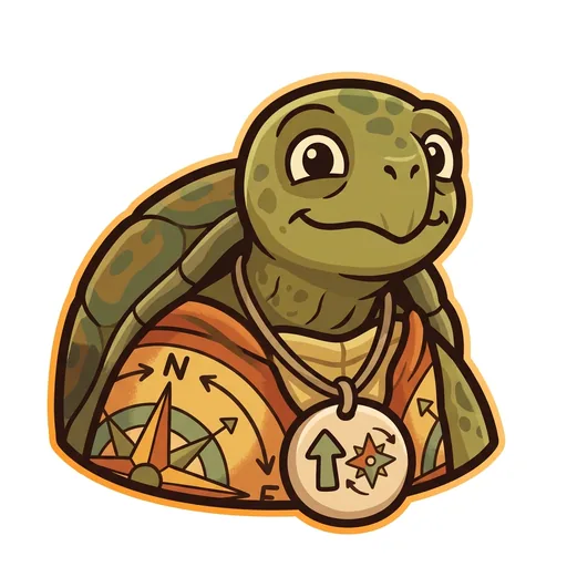
Bearing
Orientation — the tortoise-elder who treats north-up as a convention, not a truth ('north is one direction, not the direction'); teaches that orientation is a choice mapmakers make
-
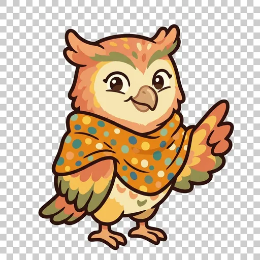
Key
Legend literacy — the owl-tween in a dot-shawl who treats the legend as the mapmaker's confession ('what's NOT on the map — that's also a map')
-
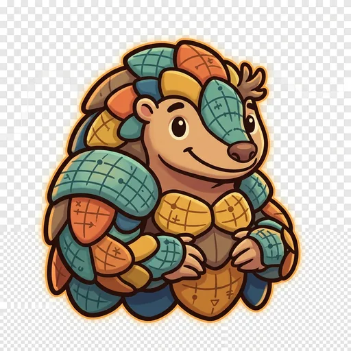
Plot
Coordinates — the pangolin-tween with graticule-scale armor who teaches that coordinate systems are human inventions, plural across cultures ('every place has many addresses; many cultures have many ways of saying here')
-
Wayfind
Non-Western mapping traditions — the heron-elder in a woven-grass cloak with stick-chart props who structurally elevates Polynesian wayfinding, Aboriginal songlines, and Indigenous TEK as peer cartographies ('some maps you sing, some you walk, some you only learn from elders')